


How to come | Directions & Itinerary
Drivers may use our customisable roadmap.
Adress
2, rue des Grandes Allées, 45250 Briare-Le-Canal (Loire Valley, Loiret, Région Centre, France)
By train
SNCF train station : Briare (Nevers - Cosne - Paris Bercy)
By road
At 1h30 in the south of Paris by the highway "A 77" or the road "N 7", exit "Briare". Nearest roads and highways : A77, N7 D47, D952, N2007The little french town of Briare is connected to the highway n°A77 (Paris-Nevers), on the "Briare-le-canal" exit. In addition, you might also join us thanks to the national road n°7, named N7 (formerly named : RN7, "route national 7" (National Road n°7), "route Bleu" ("Blue Road") or "La route des vacances" ("Holiday road") on the N7 / D952 junction.
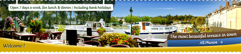
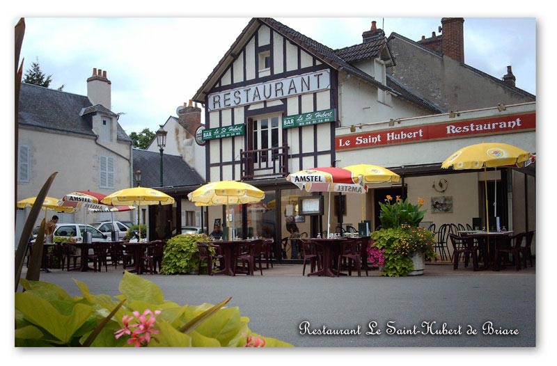
When you have arrived by one of these roads, join the road number D957, follow the "Briare Centre" and the "Port de plaisance". When you'll see a cute little bridge with flowers, turn. Go on the end of the dock named "Alexis Tchekoff", you have arrived at the restaurant Le Saint-Hubert. Near to the restaurant, 4 parkings are available for free.
GPS coordinates
47.638622, 2.734388
By boat
The Briare's marina is located on the canal named "Canal latéral à la Loire" (Digoin - Briare.) This canal begins on the "Bourgogne" region in the "Saône-et-Loire" county, through to the "Nièvre" county, enter on the "Région Centre", and come to the Briare's canal by the south-east of the Loiret county. It connected with "Rhône" and "Seine" rivers.
By bicycle
Briare is a step of national itinerary named "La Loire à vélo" ("The Loire by bicycle") and EuroVelo 6, fully connected with the european cyclotourism map.
By plane
Briare city has a dedicated airfield : Aérodrome (airfield) of Briare-Châtillon (code OACI : LFEI ), open to the french public air traffic (circulation aérienne publique, CAP in french). It is located in the Briare town territory. It accommodates for recreation and touristic activities (light aircraft and model aircraft). Briare airfield is one the three airfields available on the Loiret region, with "Pithivier" and "Montargis-Vimory".Geographical situation : this airfield is located on the Briare territory, at 4km (2 miles) south-east of Briare downtown, at 19km (11 miles) south-east of Gien city, in the "Montargis" district, on the département of "Loiret" and "Région Centre", on the north of the right bank of the Loire river, on the natural "Giennois" region. Facilities are available through the highways n°A77 (exit n°20) or via the national road n°D2007.
Cities and villages all around
Gien, Poilly-lez-Gien, Saint-Martin-sur-Ocre, Saint-Brisson-sur-Loire, Autry-le-Châtel, Saint-Firmin-sur-Loire, La Buissière, Cernoy-en-Berry, Pierrefitte-és-Bois, Ouzouer-sur-Trézée, Rogny-les-Sept-Écluses, Châtillon-sur-loire, Ousson-su-Loire, Dammarie-en-Puisaye, Batilly-en-Puisaye, Bonny-sur-Loire, Thou, Faverelles, Annay, Beaulieu-sur-Loire, Neuvy-sur-Loire
Customize your direction with Google Map
Get direction in three clicks only :1. Click on the red mark in the middle of the following map.
2. Click on the icon "Direction" on the top right corner of the red banner.
3. A new page is displayed, on which you can put your point of departure (e.g : London).
4. It's done ! You have a custom itinerary ready to use.
")